West Coast Division (Bahagian Pantai Barat)
West Coast Division (Bahagian Pantai Barat) is an administrative division of Sabah, Malaysia. It occupies the northwest portion of Sabah. With an area of 7,588 square kilometres, it occupies 10.3% of Sabah's territory. It also has approximately 30% of Sabah's total population, with the main indigenous inhabitants comprising the Bajau, Bisaya, Bruneian Malay, Dusun, Illanun, Kadazan and Kedayan, as well with a significant numbers of Chinese. The division is divided into the districts of Ranau, Kota Belud, Tuaran, Penampang, Papar, and the state capital Kota Kinabalu. The main towns are as in the names of the districts, plus other towns including Putatan, Inanam, Telipok, Tamparuli, Tenghilan and Kinarut.
Kota Kinabalu Harbour is the main sea ports in the state's capital with an estimate size of 1,440 kilometres long coast. It serves as the gateway for water transport in Sabah. It handles and handles 4,031,000 freight tonne annually. The Kota Kinabalu International Airport serves as the main gateway into the state by air.
West Coast Division is subdivided into the following administrative districts:
* Kota Belud District (1,386 km2) (Kota Belud Town)
* Kota Kinabalu District (350 km2) (Kota Kinabalu City)
* Papar District (1,234 km2) (Papar Town)
* Penampang District (466 km2) (Penampang Town)
* Putatan District (29,7 km2) (Putatan Town) – recently established in 2007
* Ranau District (2,978 km2) (Ranau Town)
* Tuaran District (1,165 km2) (Tuaran Town)
Map - West Coast Division (Bahagian Pantai Barat)
Map
Country - Malaysia
 |
 |
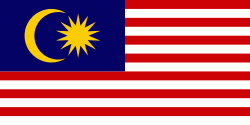
| Flag of Malaysia | |
Malaysia has its origins in the Malay kingdoms, which, from the 18th century on, became subject to the British Empire, along with the British Straits Settlements protectorate. Peninsular Malaysia was unified as the Malayan Union in 1946. Malaya was restructured as the Federation of Malaya in 1948 and achieved independence on 31 August 1957. The independent Malaya united with the then British crown colonies of North Borneo, Sarawak, and Singapore on 16 September 1963 to become Malaysia. In August 1965, Singapore was expelled from the federation and became a separate independent country.
Currency / Language
| ISO | Currency | Symbol | Significant figures |
|---|---|---|---|
| MYR | Malaysian ringgit | RM | 2 |
| ISO | Language |
|---|---|
| ZH | Chinese language |
| EN | English language |
| MS | Malay language |
| ML | Malayalam language |
| PA | Panjabi language |
| TA | Tamil language |
| TE | Telugu language |
| TH | Thai language |


